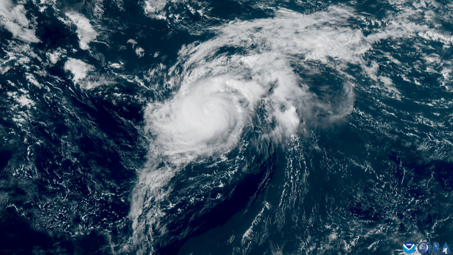
A tropical wave crossing the Atlantic carried a 70% chance of becoming a tropical depression within seven days, the National Hurricane Center said Tuesday, Aug. 25. The system, designated Invest 96L, represented a notable change from the quiet outlook forecasters had given Northeast Florida 10 days earlier.
As of 2 a.m. Tuesday, the NHC classified 96L’s seven-day development probability as high and its 48-hour chance at 60%. The area of low pressure was a few hundred miles south-southeast of the Cabo Verde Islands, producing disorganized showers and thunderstorms while moving west to west-northwest across the tropical Atlantic, according to the Jacksonville.com report.
By 2 p.m. Tuesday, the NHC had raised 96L’s 48-hour development chance to 70%, matching its seven-day probability. The agency said environmental conditions appeared conducive for gradual development during the next day or two, though conditions could become less favorable by the weekend.
“While many forecasting models produce a storm that curves into the open ocean, people on the eastern seaboard should keep their eyes on this wave as it progresses across the Atlantic,” AccuWeather Lead Hurricane Expert Alex DaSilva said Monday, Aug. 24. “Any potential U.S. impacts wouldn’t happen until late next week.”
Many forecast models showed 96L turning into the open Atlantic. If the system remains organized and passes northeast of the Leeward Islands late this weekend or early next week, conditions could become more favorable for strengthening north of Puerto Rico, according to AccuWeather.
The NHC does not issue official intensity forecasts for invests. Several computer-model simulations showed 96L becoming a hurricane and tracking north of the Caribbean, but FOX Weather hurricane specialist Bryan Norcross said that possibility was still more than a week away and not something to focus on yet, the Palm Beach Post reported.
Mandarin’s flood exposure
Parts of Mandarin fall within Duval County evacuation zones D, E and F, according to First Coast News. Zone F includes areas along the St. Johns River that are vulnerable to flooding.
Hurricane Irma caused significant river flooding in Jacksonville and rainfall across Northeast Florida in September 2017. Residents should use current official forecasts and evacuation-zone information rather than applying regional Irma rainfall totals to a specific Mandarin property.
The City of Jacksonville’s JaxReady.com guidance urges residents to stock a supply kit, review their family emergency plan and know their evacuation zone. The linked city notice concerns 2025 systems, not Invest 96L. Residents can look up their zone at maps.coj.net/evsearch or call 630-CITY.
Season context
The 2026 Atlantic hurricane season had produced three named storms and an Accumulated Cyclone Energy value of 3.1 through Aug. 25, well below the 1991-2020 seasonal average at that point. Colorado State University’s Aug. 5 seasonal outlook forecast nine named storms, four hurricanes and one major hurricane for the full season.
NOAA’s updated seasonal forecast continued to call for a below-normal year, citing a strengthening El Niño as the main factor suppressing Atlantic tropical development. NOAA’s Aug. 6 update projected a 75% chance of below-normal activity, with seven to 13 named storms, two to six hurricanes and zero to two major hurricanes.
Still, it is hurricane season. DaSilva warned Tuesday, “A lot of people may have tuned this season out and then suddenly you have something on your doorstep. There’s nothing immediate happening but it’s still hurricane season.”
The statistical peak of the Atlantic hurricane season is Sept. 10, and the most active period generally runs from mid-August through mid-October. The NHC’s Tropical Weather Outlook is typically issued four times daily while systems are being monitored; residents should follow updates at hurricanes.gov.
.jpg)